Balearic Seamounts Expedition 2014
Balearic Seamounts Expedition 2014
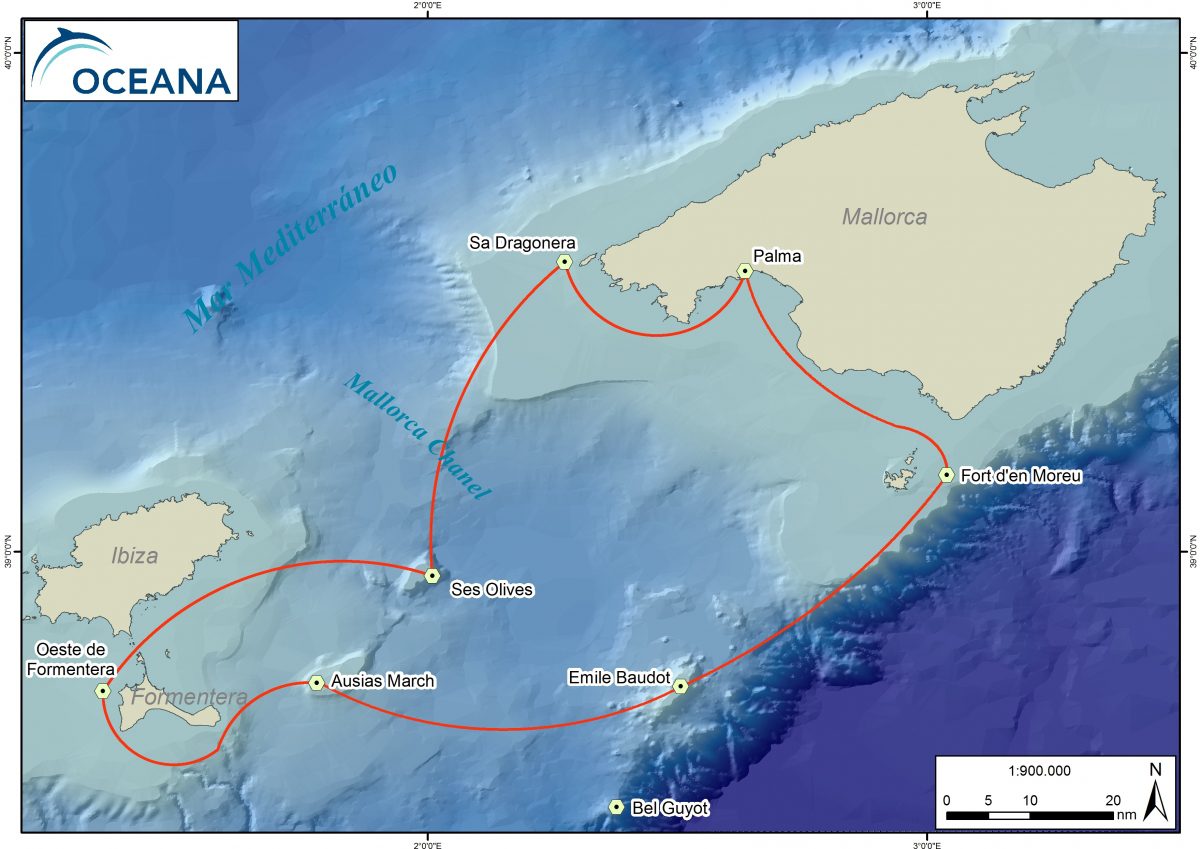
This expedition aims to document and map a series of seamounts in the Mallorca Channel (Emile Baudot, Ausias March and Ses Olives) as well as the coralligenous reef called Fort d’en Moreu, which lies east of the Cabrera archipelago.
SHARE THIS EXPEDITION TO SHOW YOUR SUPPORT:
Overview
This expedition aims to document and map a series of seamounts in the Mallorca Channel (Emile Baudot, Ausias March and Ses Olives) as well as the coralligenous reef called Fort d’en Moreu, which lies east of the Cabrera archipelago.
The purpose of this campaign is to continue gathering information, which began back in 2006, in order to assess the need for protection in these areas.
We chose to carry out the expedition because the Mallorca Channel, which separates the islands of Mallorca and Ibiza, contains three elevations of great importance to the Balearic area.
The highest of these elevations is Emile Baudot, rising 800 meters above the sea floor. Its origins lie in volcanic activity, while Ausias March and Ses Olives arose from continental drift. Meanwhile, to the East of Cabrera, lies the fort d’en Moreu which boasts maërl beds and kelp forests.

Diaries
The Crew
ENRIQUE TALLEDO
Underwater videographer (Spain)
JOSÉ MANUEL SÁEZ
ROV's Technician (Spain)
ALBERT FERRER
ROV's Technician (Spain)
Videos

